

Big Bear Lake hiking & biking trails
Map Purpose
Help visitors explore the outdoors by providing a clear overview of all hiking and mountain biking trails in Big Bear Lake, including difficulty levels and nearby amenities.
Challenge
Display 13 different trails and their difficulty levels, while also showing the location of key points of interest like campgrounds, picnic areas, and wildlife refuges, without overloading the visual layout.
Project Description
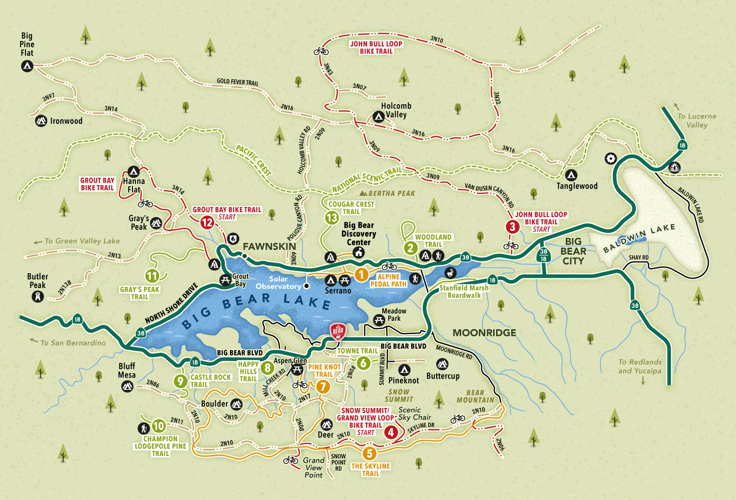
This map charts 13 hiking and biking trails in the Big Bear Lake area using a numbered and color-coded system to indicate trail difficulty. Only the most essential roads are included, and soft graphic elements suggest vegetation to evoke the area's natural beauty.
Illustrations
Due to the density of information, the visual approach leans on minimalist black-and-white iconography. Generic symbols represent campgrounds, interpretive centers, picnic spots, and bike routes, supporting the map’s practical use while staying visually balanced.
- UseVisitors guide
- ClientVisit Big Bear
- Related projectsBig Bear Lake water activities
- Type of clientsTourism board, destination marketing organization
- Art DirectorDeanne O'Connor
- LocationBig Bear Lake, California, USA
- CreditsThis 100% vector map was created by Greg Franco - Le Cartographiste with Adobe Illustrator and without the help of AI.
