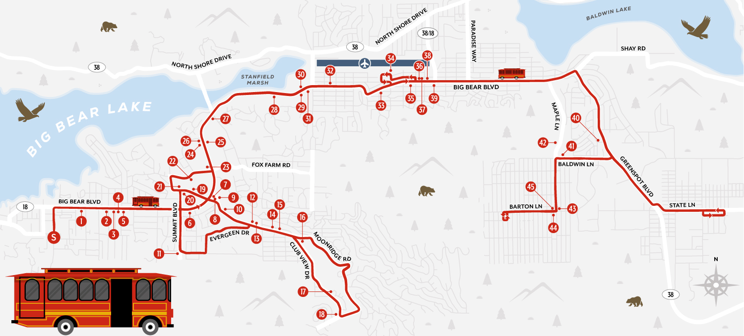
Map Purpose
Promote the free Big Bear Trolley service and help visitors understand the route and stops for navigating Big Bear Lake car-free.
Challenge
Create a transit map that is highly functional yet friendly and visually engaging, combining accuracy with a welcoming illustrated aesthetic.
Project Description
This map traces the complete route of the free Big Bear Trolley, including 45 stops across Big Bear Lake. Designed to be both practical and easy to read, the layout reflects the actual street network while enhancing the overall visitor experience through a clear, inviting design.
Illustrations
To bring the map to life, custom illustrations of the trolley, local wildlife, vegetation, and terrain were added, bringing fun to an otherwise very practical transit guide.