

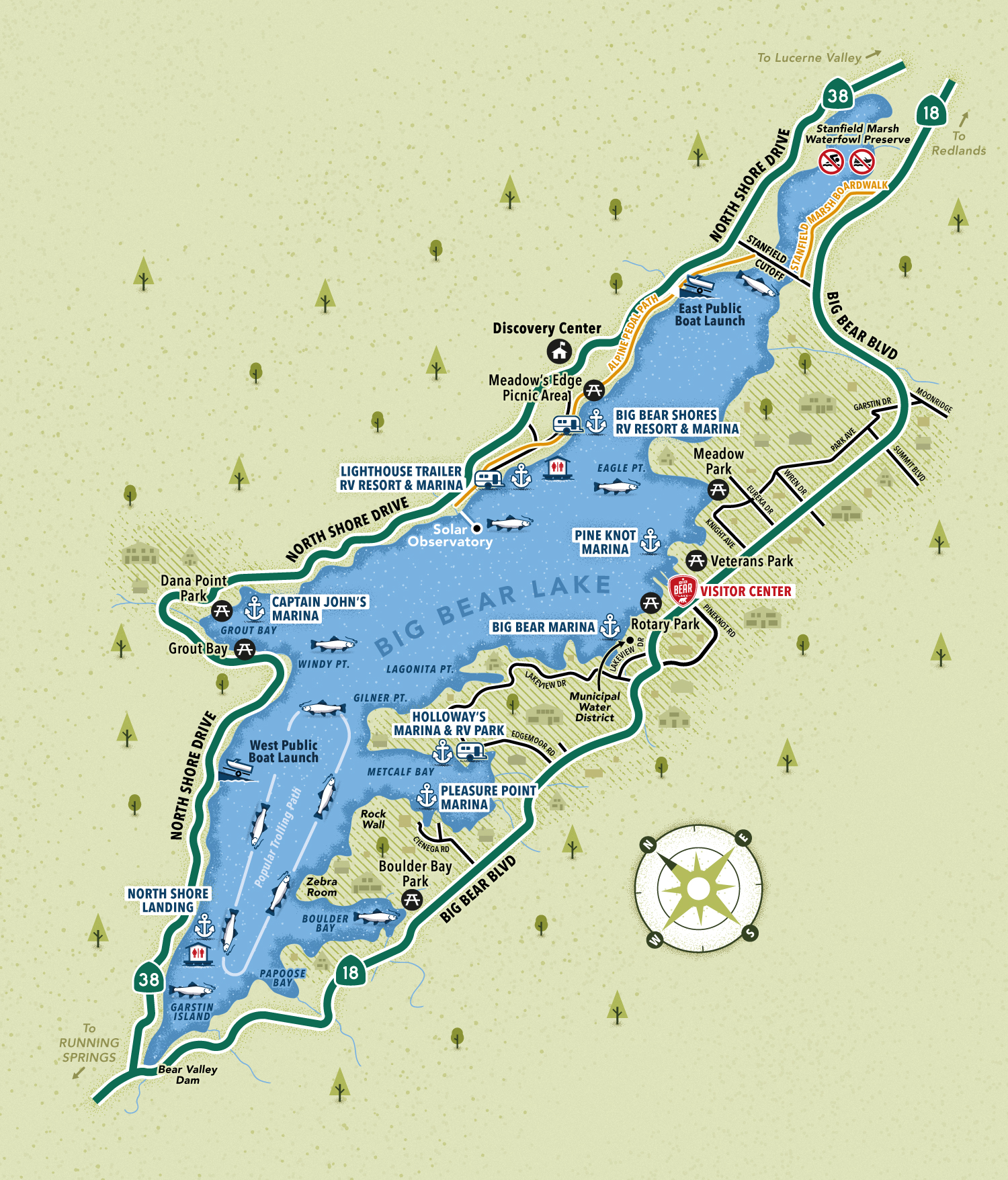
Big Bear Lake water activities map
Map Purpose
Help visitors make the most of their lakeside stay by showing key locations for boating, fishing, picnicking, and camping around Big Bear Lake.
Challenge
Design a user-friendly and visually engaging map that simplifies the area without omitting useful details, perfect for a broad audience of outdoor enthusiasts.
Project Description
This illustrated map focuses on water-based recreational activities around Big Bear Lake. A clean, minimalist design shows only the key roads and thoroughfares that lead to the lake’s main access points. The layout balances informative content with playful visuals to reflect the region’s outdoor charm and family-friendly atmosphere.
Illustrations
A full set of custom icons was created to represent boat launches, fishing spots, marinas, RV parks, floating toilets, and picnic areas. These icons, along with stylized trees and houses, add character while improving navigation and readability.
- UseVisitors guide
- ClientVisit Big Bear
- Related projectsBig Bear Lake hiking and biking trail
- Type of clientsTourism board, destination marketing organization
- Art DirectorDeanne O'Connor
- LocationBig Bear Lake, California, USA
- CreditsThis 100% vector map was created by Greg Franco - Le Cartographiste with Adobe Illustrator and without the help of AI.
