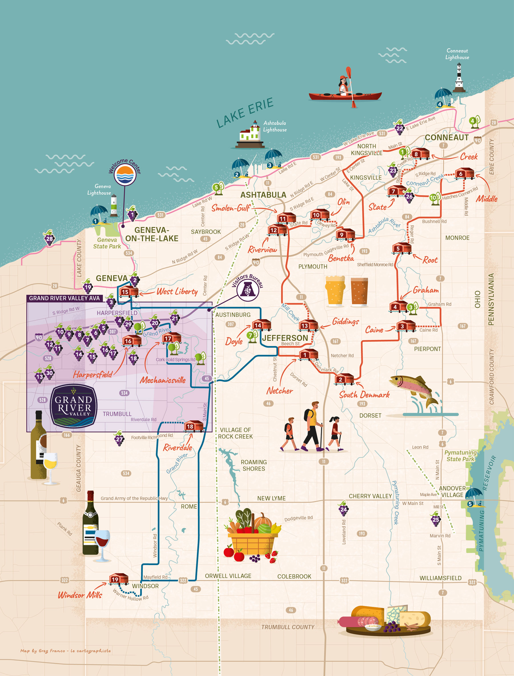
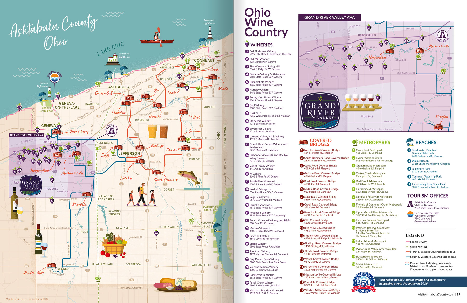


Map Purpose
Help visitors easily locate the wineries and covered bridges of Ashtabula County while encouraging them to explore the broader region.
Challenge
Design a creative and engaging map featuring a high number of locations sorted in 6 categories (31 wineries, 19 covered bridges, 15 metro parks, 5 beaches, 2 tourism offices, 3 lighthouses ,1 scenic byway, 2 covered bridge driving tours, 1 walking trail) while keeping it easy to use and integrating illustrations that enhance the map without overwhelming the geographic information.
Project Description
Located along the shores of Lake Erie, Ashtabula County is known as Ohio Wine Country and is home to the largest collections of covered bridges in the state. The map serves as a practical navigation tool while visually conveying the character of the destination.
The county is presented with clearly labeled roads, townships, and routes near each point of interest. Each POI category is represented by a dedicated icon system, and all locations are numbered for easy cross-referencing within the visitor guide.
The zoomed-in inset of the Grand River Valley ensures that every winery remains clearly readable despite the density of locations in that area.
The map is featured in the 2026 Ohio Wine Country - Ashtabula County visitors guide.
Illustrations
The eight illustrations were designed in a fun, modern style aligned with the destination’s brand identity. They depict outdoor activities, wine-tasting and elements of the local food culture.
These illustrated elements bring warmth and personality to the map while preserving clarity and usability. The goal was to give visitors a visual sense of the area’s atmosphere and encourage exploration.
