

Bay Area Tourist Map for Pleasant Hill, CA
Map Purpose
Promote Pleasant Hill as a well-connected travel base by showing its proximity to top Bay Area destinations and travel hubs.
Challenge
Design a clean, legible map that conveys driving times to major points of interest across a wide region (from San Jose to Sacramento) while keeping the layout simple and user-friendly.
Project Description
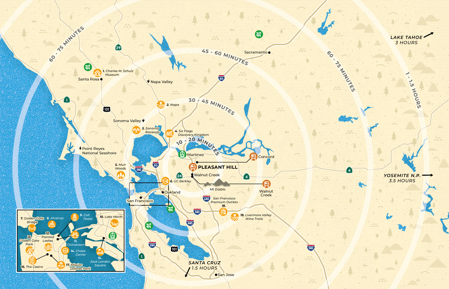
This custom tourist map uses concentric circles radiating from Pleasant Hill to indicate estimated driving times to a selected list of attractions. To help visitors quickly locate nearby options, a zoomed-in inset highlights San Francisco and Oakland in greater detail. The map serves as a visual tool to position Pleasant Hill as a central, accessible destination for Bay Area exploration.
Illustrations
To maintain clarity, 19 points of interest—including landmarks, airports, and train stations—are represented through custom vector icons. These minimal line-art designs were crafted to reflect each location’s unique identity, from Muir Woods and Charles M. Schultz Museum to the Painted Ladies and the Castro District in San Francisco.
- UseVisitors guide
- ClientStay Pleasant Hill
- Type of clientsTourism board / Destination marketing organization
- Art DirectorDeanne O'Connor
- LocationPleasant Hill, San Francisco, California, USA
- CreditsThis 100% vector map was created by Greg Franco - Le Cartographiste with Adobe Illustrator and without the help of AI.
