

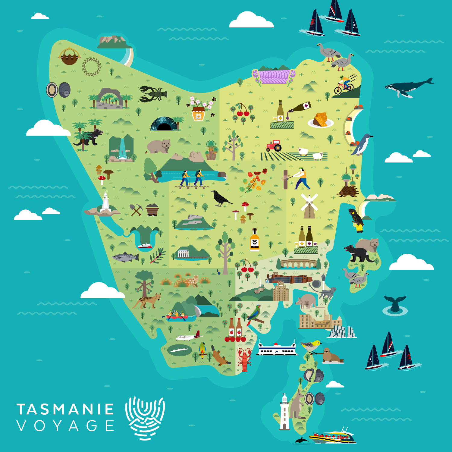
Illustrated map of Tasmania
Map Purpose
Inspire travelers to explore Tasmania by visually showcasing the island’s rich biodiversity, cultural sites, food, and outdoor experiences.
Challenge
Create a comprehensive and visually captivating illustrated map that integrates 75 individual illustrations in a cohesive layout while keeping the composition fun, balanced, and visually appealing.
Project Description
This vibrant promotional map presents Tasmania in a playful and immersive way, using illustration as the main storytelling tool. Instead of geographical details like towns or roads, the focus is placed entirely on attractions, flora, fauna, food, and landmarks. The final result functions both as a large poster and a flexible promotional asset across various printed formats.
Illustrations
75 stand-alone illustrations were crafted in a clean geometric vector style. From Tasmanian devils and local botanicals to historical buildings and regional cuisine, each icon was designed to be reused independently on brochures, merchandise, or travel guides.
- UsePromotional item, poster, brochure
- ClientTasmanie Voyage
- Type of clientsTour agency / Travel
- LocationTasmania, Australia
- CreditsThis 100% vector map was created by Greg Franco - Le Cartographiste with Adobe Illustrator and without the help of AI.
