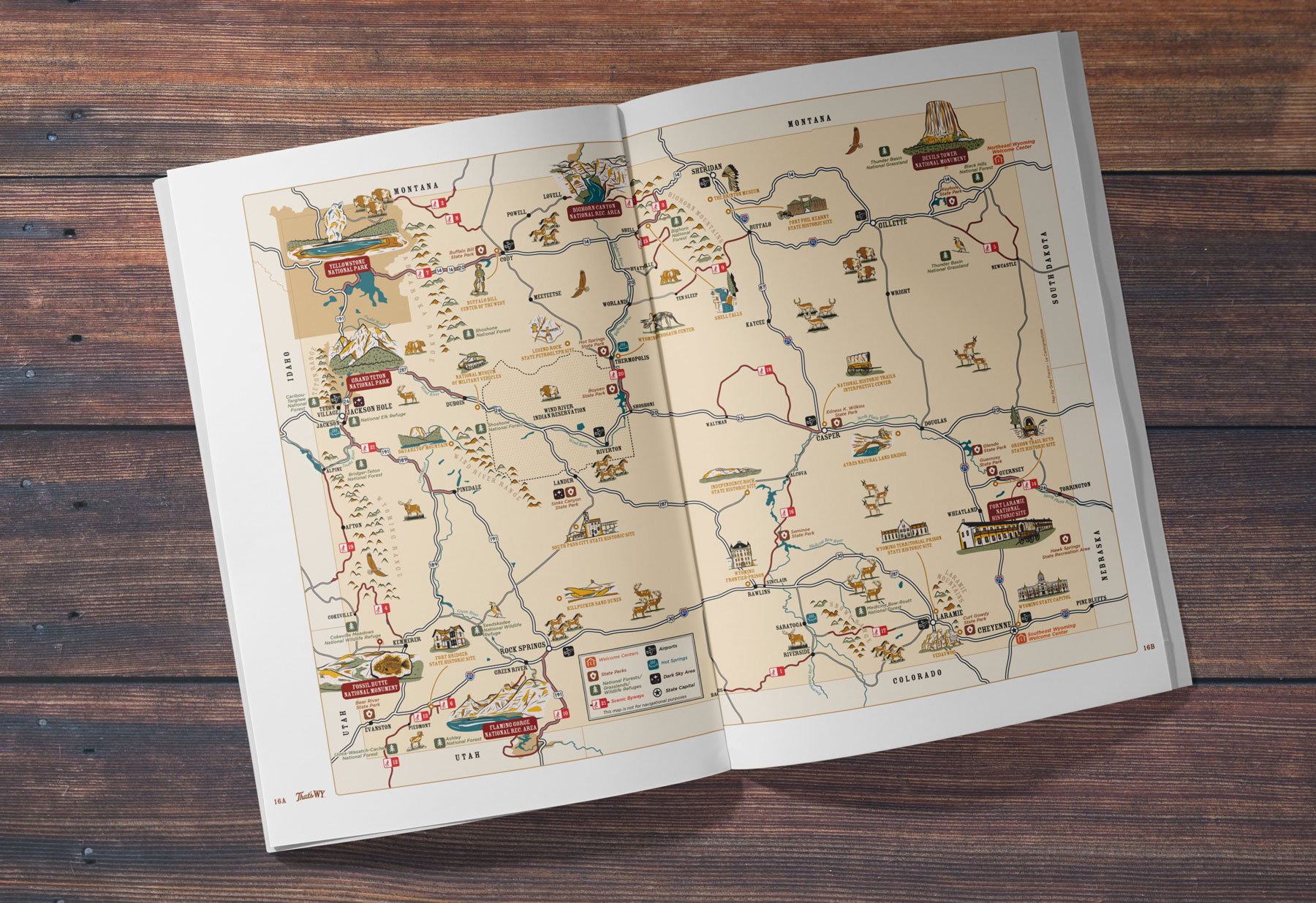


Map Purpose
Providing visitors with a clear overview of the state of Wyoming, helping them quickly identify key destinations, natural areas, and travel routes while adding a strong visual sense of place.
Challenge
The map had to combine functional elements (transportation networks, public lands, and visitor facilities) with locating 70+ points of interest as well as 36 illustrated landmarks, scenery, and wildlife, all while aligning with the guide’s established graphic system. Maintaining clarity without sacrificing personality was the central challenge.
Project Description
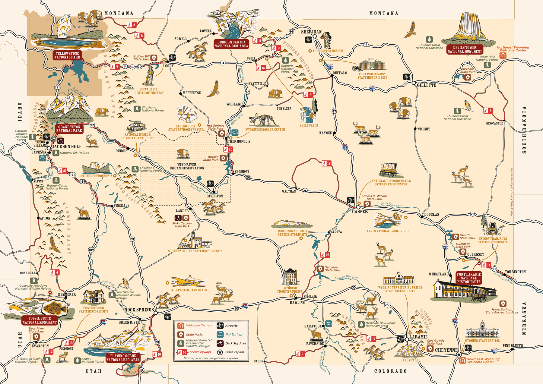
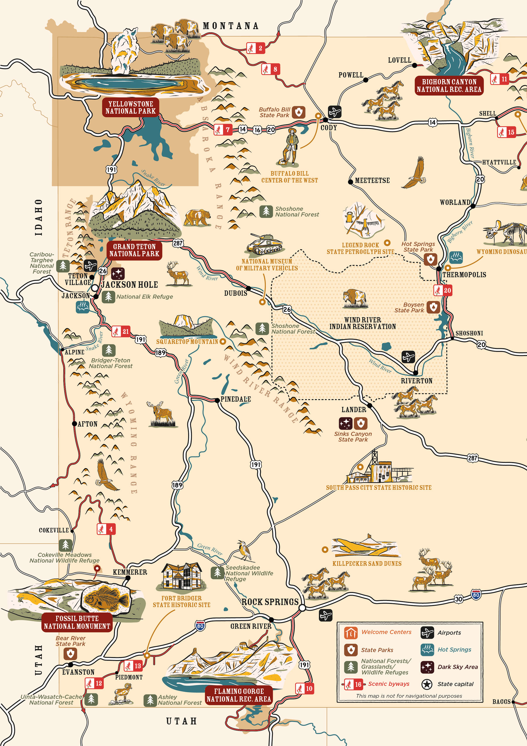
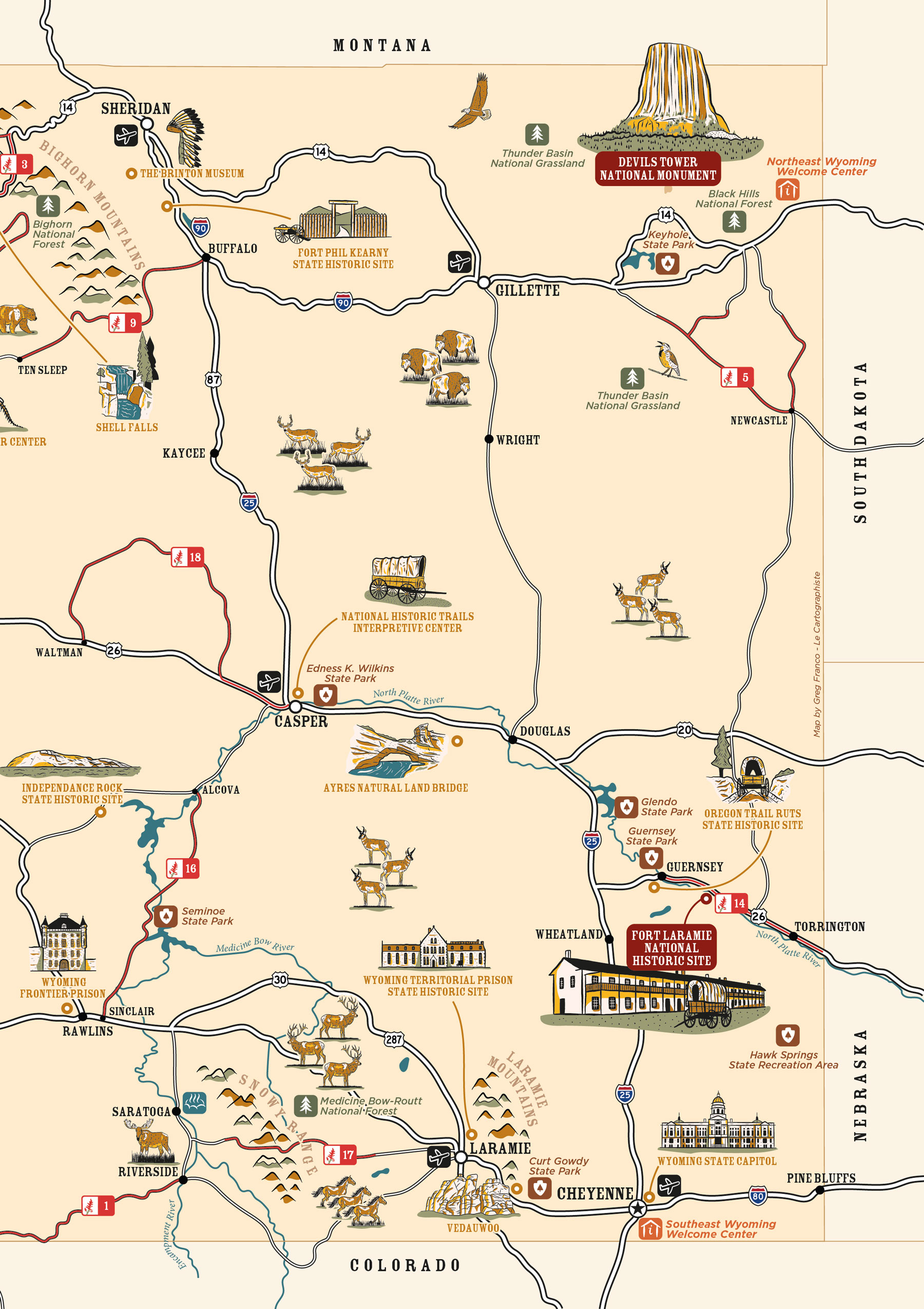
Commissioned for the 2026 Travel Wyoming Visitor Guide, this illustrated map serves as the publication’s main orientation map across a two-page spread.
Representing a state as large and varied as Wyoming required condensing extensive geographic and tourist information into a format that remained simple and intuitive to read. The composition includes welcome centers, state parks, national forests, grasslands, wildlife refuges, airports, hot springs, dark sky areas, and scenic byways, along with major highways, rivers, mountain ranges, and the Wind River Indian Reservation.
The artwork was developed using custom-drawn icons and illustrations, supported by a restrained color palette to ensure consistency with the guide’s design and smooth readability at print scale.
Illustrations
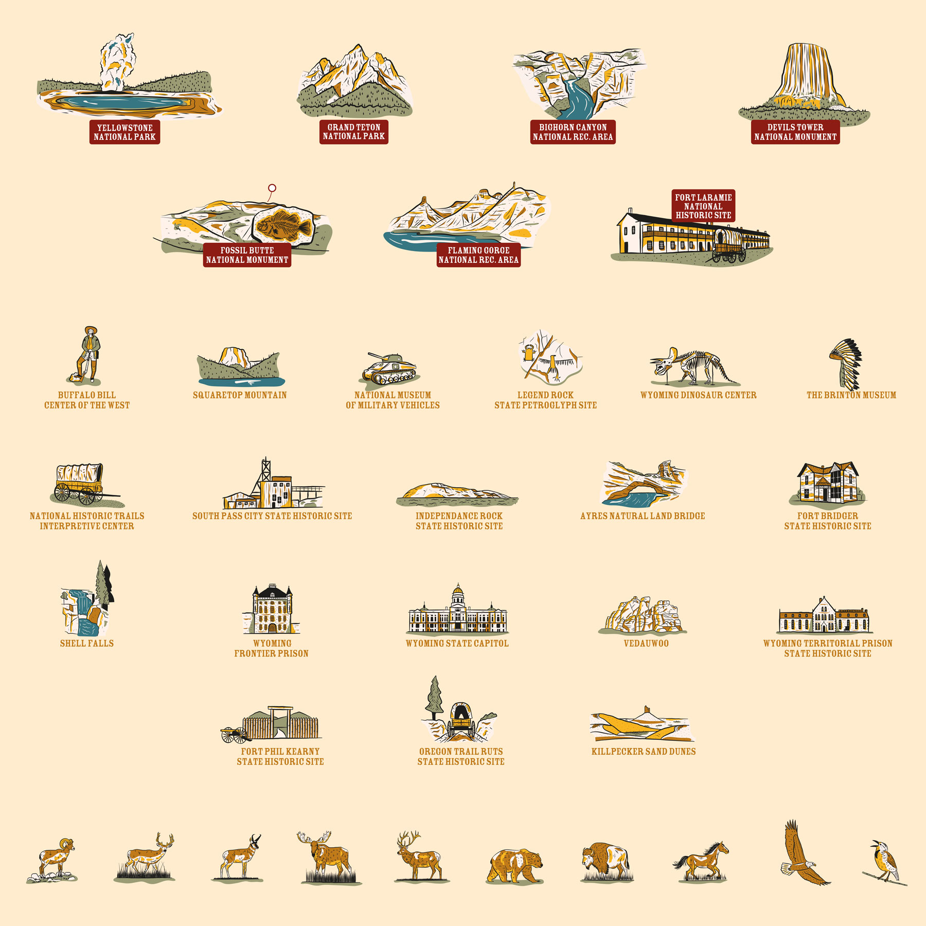
The project features 36 original hand-drawn spot illustrations highlighting Wyoming’s most recognizable places and environments, including Yellowstone and Grand Teton National Parks, Bighorn Canyon and Flaming Gorge National Recreation Areas, Fossil Butte National Monument, Fort Laramie National Historic Site, museums, geological landmarks, and native wildlife such as bison, elk, grizzlies, and bighorn sheep.
