Map Purpose
Promote Deutsche Bahn’s, Regio Bayern regional ticket offerings by showcasing landmarks and destinations easily accessible by local train travel across Bavaria.
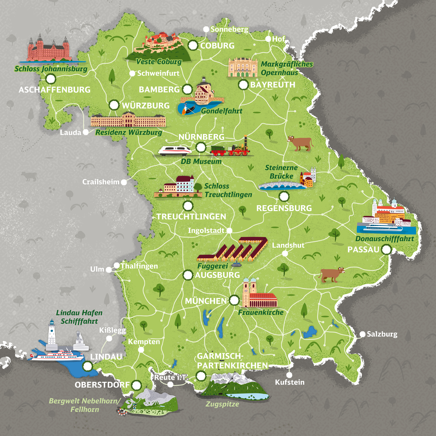
Challenge
Create a series of fun illustrated maps adaptable across print, online, and advertising formats while accurately representing Bavaria’s rail network and maintaining geographic scale.
Project Description
This set of seven illustrated maps was developed for Deutsche Bahn, Regio Bayern to highlight key regions of Bavaria, including Munich, Nuremberg, and the Danube area. Featuring 50 hand-drawn landmarks, the maps balance playful visuals with precise representation of the railway connections, encouraging visitors to explore Bavaria car-free.
Illustrations Fifty hand-drawn illustrations represent key museums, monuments, and attractions across Bavaria. The illustrations are colorful and lively, designed to make travel planning more inviting and engaging for both tourists and locals.
CreditsThese 100% vector maps were created by Greg Franco - Le Cartographiste with Adobe Illustrator and without the help of AI.
Adobe Illustrator brushes from RetroSupply Co.