

Illustrated map of Iran
Map Purpose
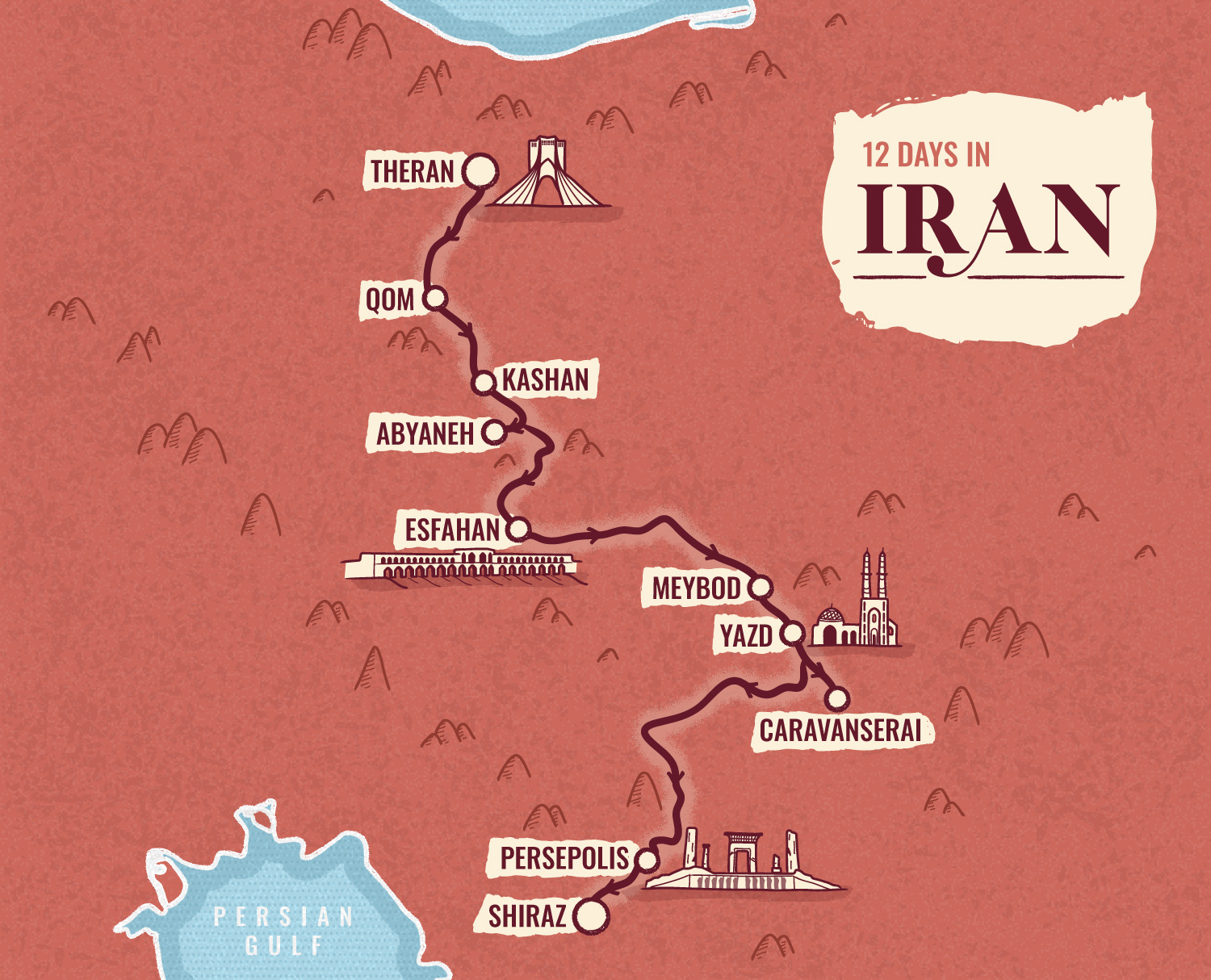
Promote a cultural tour of Iran by visualizing the itinerary across key cities and historic sites in a clear, inviting illustrated format.
Challenge
Design a simple, easy-to-follow itinerary map that visually communicates the richness of the tour without overcrowding the layout.
Project Description
Created for Patch Adventures, this illustrated map traces a curated route from Tehran to Shiraz through some of Iran’s most historic and beautiful cities. Designed for use on both web and in brochures, the map captures the tour’s highlights while reflecting the destination’s rich cultural heritage in a clean and accessible way.
Illustrations
Minimalist hand-drawn illustrations feature iconic landmarks such as the Azadi Tower in Tehran, Khaju Bridge in Esfahan, Jameh Mosque of Yazd, and the ancient ruins of Persepolis. The visuals provide a quick and engaging overview of what travelers can expect to see.
- UseWebsite, brochure
- ClientPatch Adventures
- Related projectsIllustrated itinerary in Morocco Illustrated itinerary in Tanzania
- Type of clientsTour agency / Travel
- LocationIran, Tehran, Shiraz, Qom, Kashan, Abyaneh, Esfahan, Meybod, Yazd, Persepolis
- CreditsThis 100% vector map was created by Greg Franco - Le Cartographiste with Adobe Illustrator and without the help of AI. Adobe Illustrator brushes from RetroSupply Co.
