

Illustrated map of Morocco
Map Purpose
Promote a guided itinerary across Morocco by visualizing the route and key highlights in a friendly, engaging illustrated format.
Challenge
Create a visually simple yet effective map that captures the essence of the tour while making each destination feel distinct and memorable.
Project Description
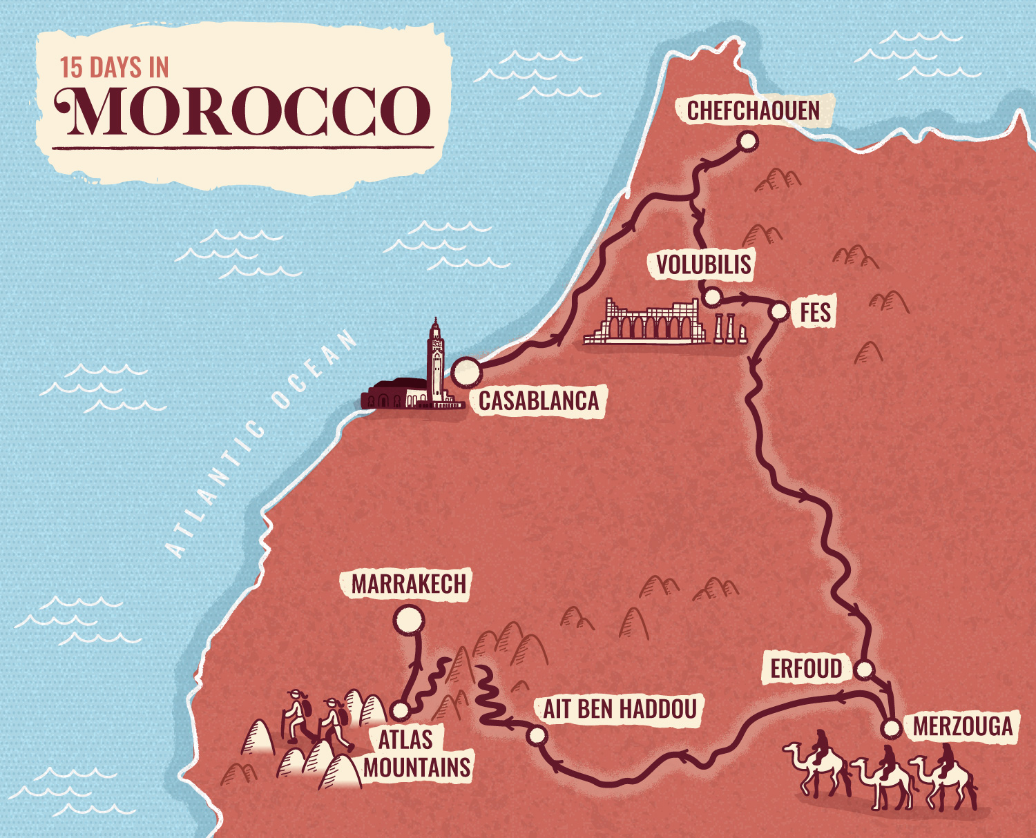
This illustrated map was designed for Patch Adventures, an Australian travel agency, to accompany their Moroccan tour. The route runs from Casablanca to Marrakech, showcasing the diversity of Moroccan landscapes and landmarks. The goal was to present the tour in a visually digestible format for both print and web, inviting travelers to imagine their journey before it begins.
Illustrations
Minimalist, hand-drawn illustrations highlight cultural landmarks like the Hassan II Mosque in Casablanca and the Roman ruins of Volubilis, alongside activities such as camel trekking in the Sahara and hiking in the Atlas Mountains. Each visual adds character without overwhelming the itinerary.
- UseWebsite, brochure
- ClientPatch Adventures
- Related projectsIllustrated itinerary in Iran Illustrated itinerary in Tanzania
- Type of clientsTour agency / Travel
- LocationMorocco, Casablanca, Marrakech, Chefchaouen, Volubilis, Fes, Erfoud, Merzoouga, Ait Ben Haddou, Atlas Mountain
- CreditsThis 100% vector map was created by Greg Franco - Le Cartographiste with Adobe Illustrator and without the help of AI. Adobe Illustrator brushes from RetroSupply Co.
