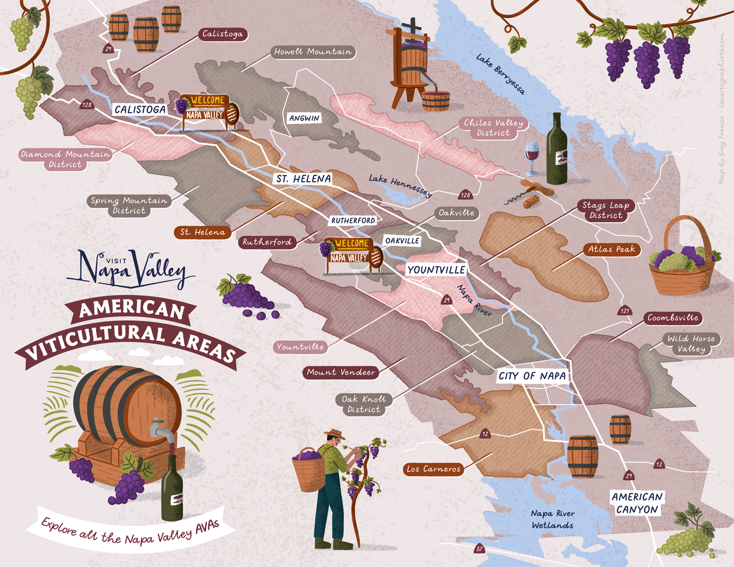
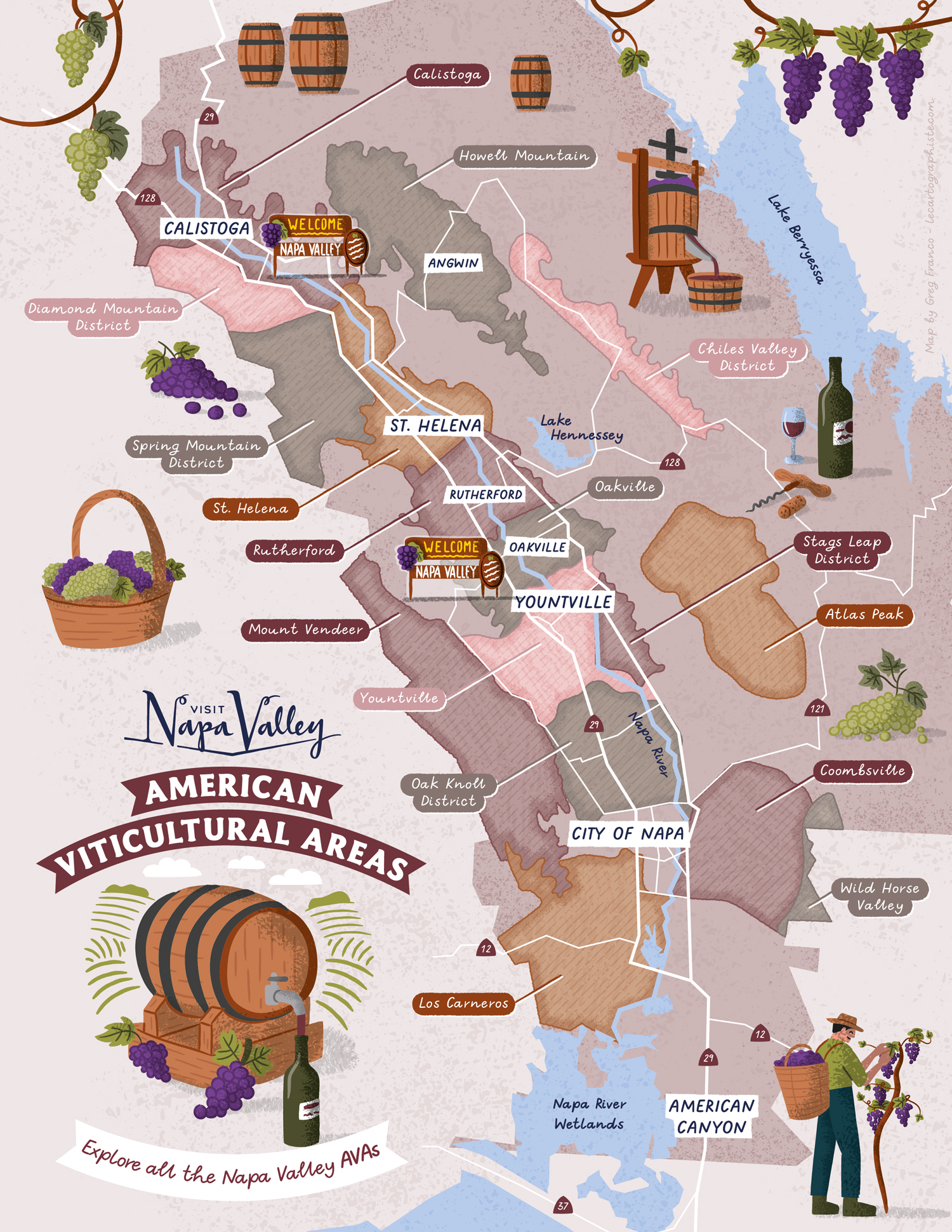
Map Purpose
Identify and promote the 17 distinctive American Viticultural Areas (AVAs) across Napa Valley through a playful and informative illustrated map.
Challenge
Create a lively illustrated map in two formats that clearly outlines each AVA while maintaining an engaging and artistic design style.
Project Description
This illustrated AVA map helps visitors understand the layout of Napa Valley’s wine regions. The map uses wine-inspired color palettes, handwritten labels, and stylized shapes to represent the unique boundaries of each AVA. Designed to appeal to visitors and wine enthusiasts alike, it brings a touch of creativity to geographic information.
Illustrations Oversized vector illustrations depict different stages of the winemaking process, from grape picking to barrel storage, enhancing the map’s storytelling while maintaining a playful, hand-drawn look.
Type of ClientsTourism board / Destination marketing organization
LocationCalistoga, St. Helena, Yountville, City of Napa, American Canyon, Napa Valley, California, USA
CreditsThis 100% vector illustrated map was created by Greg Franco - Le Cartographiste with Adobe Illustrator and without the help of AI.
Adobe Illustrator brushes from RetroSupply Co.