Map Purpose
Promote Napa Valley’s culinary scene through themed trails focused on tacos, cheeseburgers, and craft beer, offering visitors new ways to explore.
Challenge
Create a series of illustrated maps that guide visitors through food and drink trails, balancing playful design with clear navigation.
Project Description
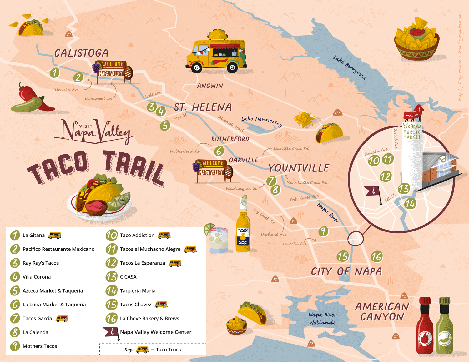
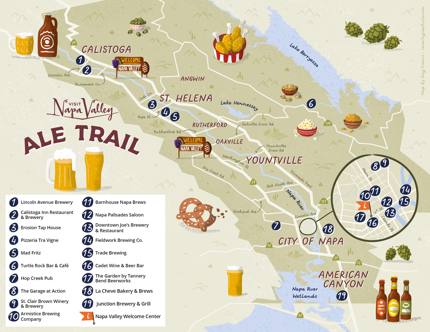
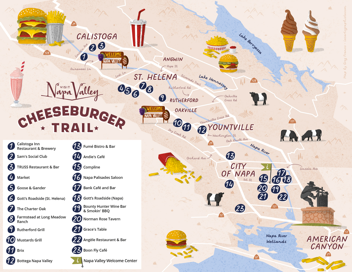
These three illustrated trail maps (Taco Trail, Cheeseburger Trail, and Ale Trail) highlight local culinary gems throughout Napa Valley. Using colorful palettes, playful lines, zoomed-in insets and legends for easy reference, they guide visitors to the best eateries, breweries, and food trucks, making exploration fun and accessible.
Illustrations Each map features themed, hand-drawn illustrations: oversized tacos, burgers, beers... designed to match the spirit of the trails, enhancing the visitor experience.
Type of ClientsTourism board / Destination marketing organization
LocationCalistoga, St. Helena, Rutherford, Oakville, Yountville, City of Napa, American Canyon, Napa Valley, California, USA
CreditsThese 100% vector illustrated maps were created by Greg Franco - Le Cartographiste with Adobe Illustrator and without the help of AI.
Adobe Illustrator brushes from RetroSupply Co.