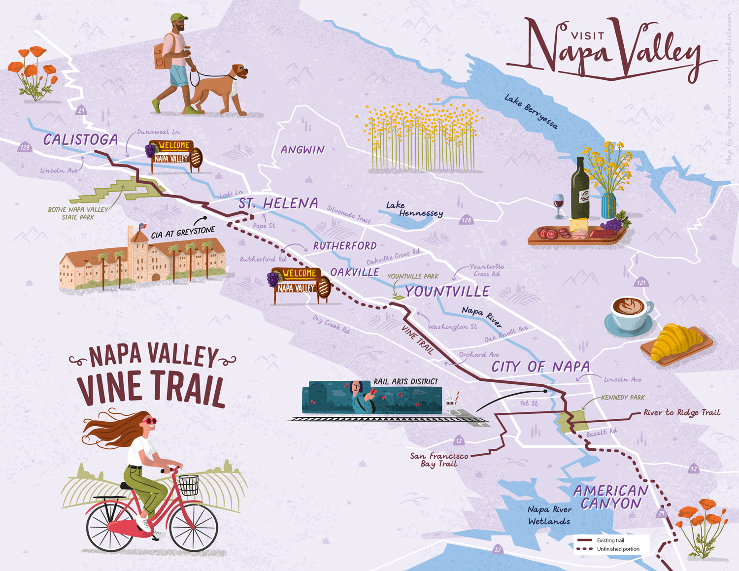
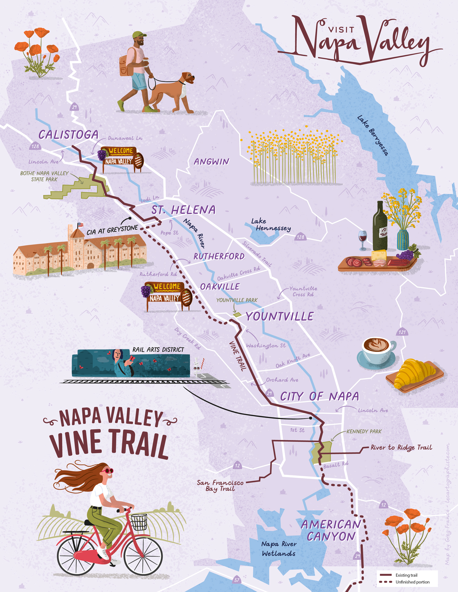
Map Purpose
Promote the Napa Valley Vine Trail, a 12.5-mile car-free path, through a fun, whimsical illustrated map that encourages visitors to explore the region.
Challenge
Create a fully illustrated map in two formats (vertical and horizontal) that balances playful design with geographic accuracy to clearly depict the Vine Trail.
Project Description
This illustrated map was designed to highlight the Napa Valley Vine Trail’s route across multiple cities while visually capturing the spirit of the area. The layout uses playful, hand-drawn elements and a custom color palette to create an inviting and vibrant atmosphere. The trail’s route is clearly visible to show that it stretches throughout the Napa Valley and the illustrations show visitors everything they can enjoy while browsing the area (from vineyards to great food and cafes to local attractions).
Illustrations They represent people, specific attractions along the way (Napa Rail Arts District, the Culinary Institute of America at Greystone), local flowers and food. They are oversized, as if standing on the map, to really stand out and convey the atmosphere of the area. Although they are 100% vector, they are in a hand-drawn style with texture and shadows.
Type of ClientsTourism board / Destination marketing organization
LocationCalistoga, St. Helena, Yountville, City of Napa, American Canyon, Napa Valley, California, USA
CreditsThis 100% vector illustrated map was created by Greg Franco - Le Cartographiste with Adobe Illustrator and without the help of AI.
Adobe Illustrator brushes from RetroSupply Co.