Shoalhaven illustrated map featured in “100 Maps of Very Special Places”
Map Purpose
Inspire people to explore the diverse natural beauty, wildlife, and lifestyle of Shoalhaven through a personal and heartfelt illustrated map.
Challenge
Select just a handful of highlights from an incredibly rich region and create a map that feels both personal and universally inviting.
Project Description
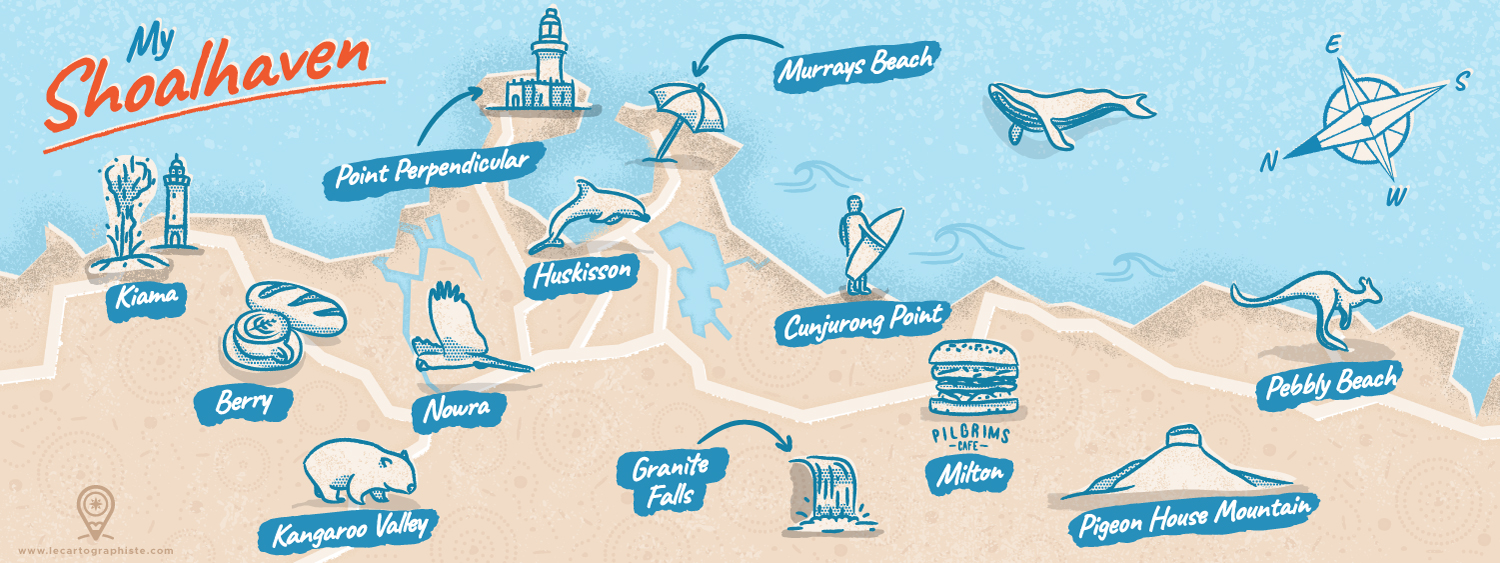
Originally created for an illustrated map contest curated by They Draw & Travel and Stroly, this hand-drawn map celebrates the Shoalhaven area, an extraordinary corner of Australia that’s deeply meaningful to me. It features a personal selection of 12 must-see places, from pristine beaches to wildlife encounters and cozy cafés. The map was chosen to appear in the book 100 Illustrated Maps of Very Special Places, published by Nate Padavick, and selected from over 340 submissions.
Illustrations
Simple hand-drawn illustrations with textured halftones capture the area’s coastal charm and biodiversity. The map evokes the everyday magic of Shoalhaven, where more than 100 beaches stretch along a 160km coastline, and wildlife like kangaroos, wombats, dolphins, and cockatoos is part of the daily scenery.
- LocationShoalhaven, New South Wales, Australia
- CreditsThis 100% vector map was created by Greg Franco - Le Cartographiste with Adobe Illustrator and without the help of AI. Adobe Illustrator brushes from RetroSupply Co.
