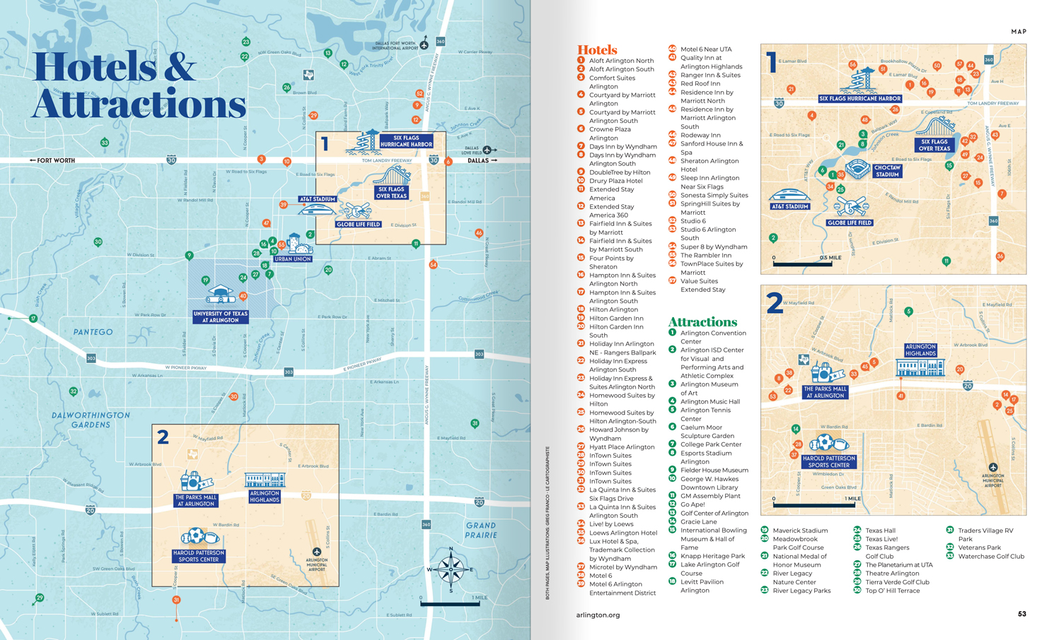
Map Purpose
Help visitors navigate Arlington easily by highlighting 90+ hotels, attractions, and major landmarks with a clean, visitor-friendly illustrated map.
Challenge
Design a comprehensive map that balances usability and creativity while fitting a high volume of locations without overwhelming the visual clarity.
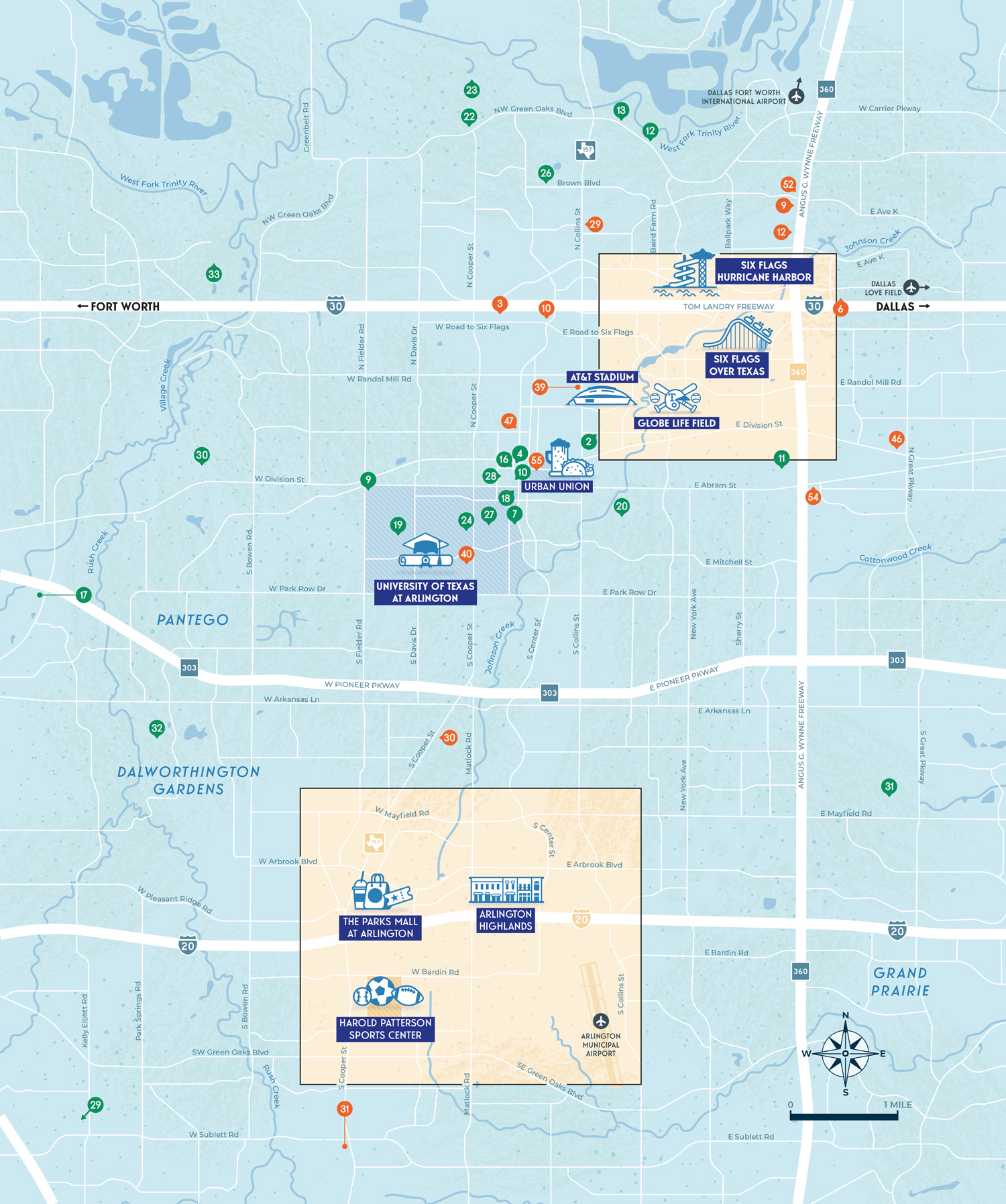
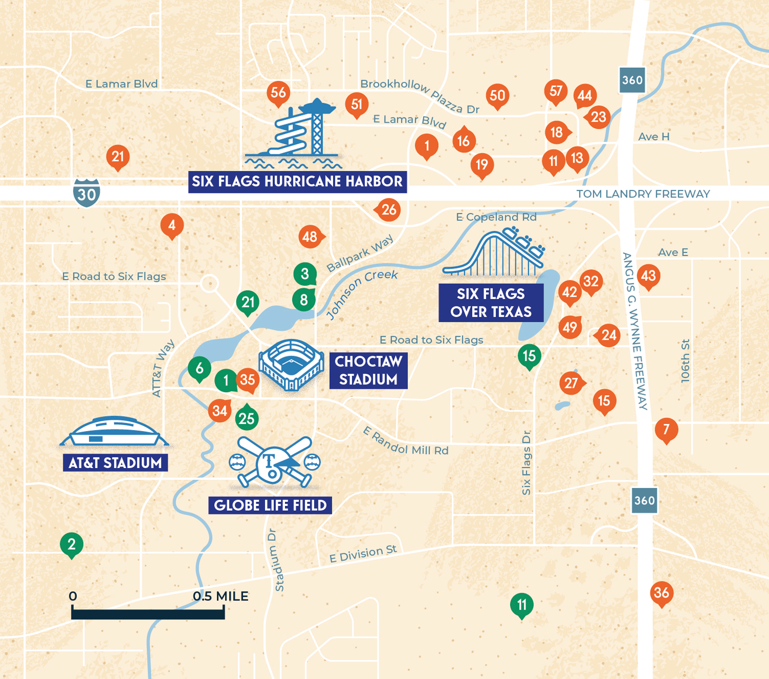
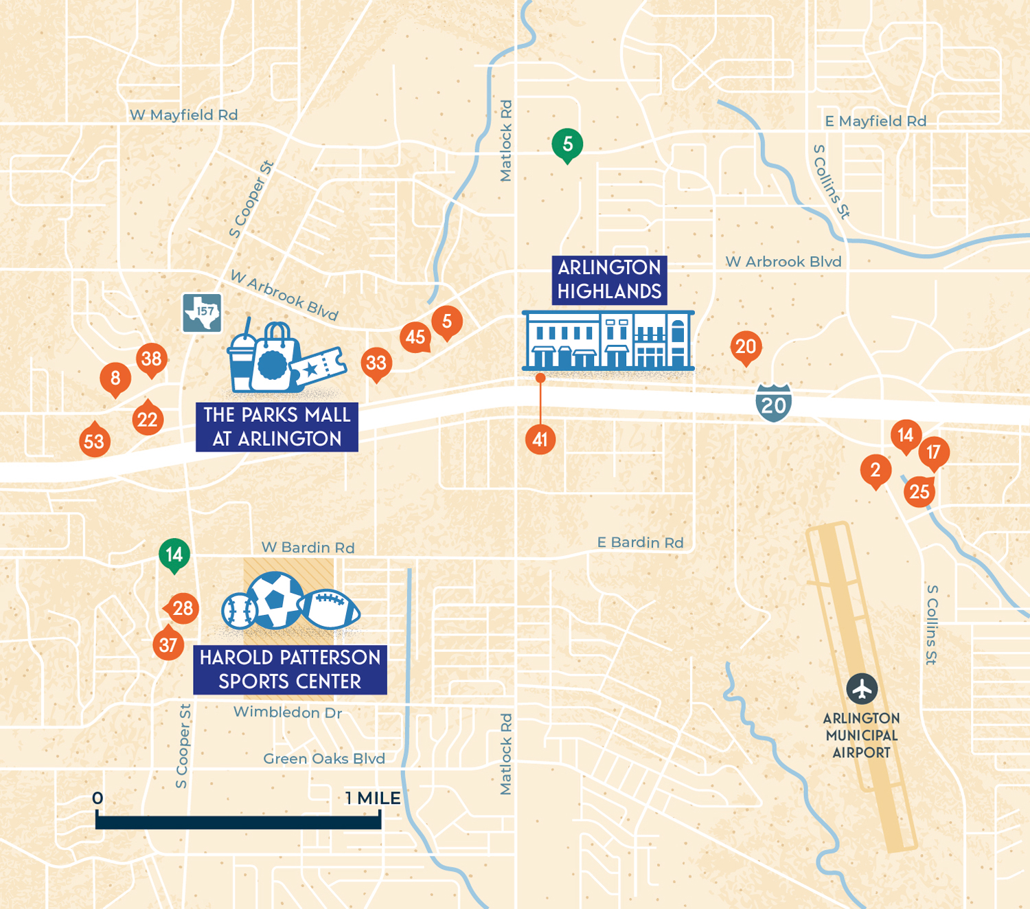
Project Description With such a high volume of locations to feature, maximizing clarity and readability was essential. I came up with the idea to span the map over a full spread and feature a large city map, complemented by two inset maps focusing on North Arlington and South Arlington. A numbered legend accompanies the maps to ensure the 57 hotels and 33 attractions are easy to locate.
Illustrations
The map includes minimalist vector illustrations of 10 iconic sites, such as AT&T Stadium, Globe Life Field, and Six Flags Over Texas. The illustrations were crafted to complement the map without overwhelming the functional design, using smooth line art for quick and easy recognition.
CreditsThis 100% vector map was created by Greg Franco - Le Cartographiste with Adobe Illustrator and without the help of AI.
Map data from OpenStreetMap
Adobe Illustrator brushes from RetroSupply Co.