

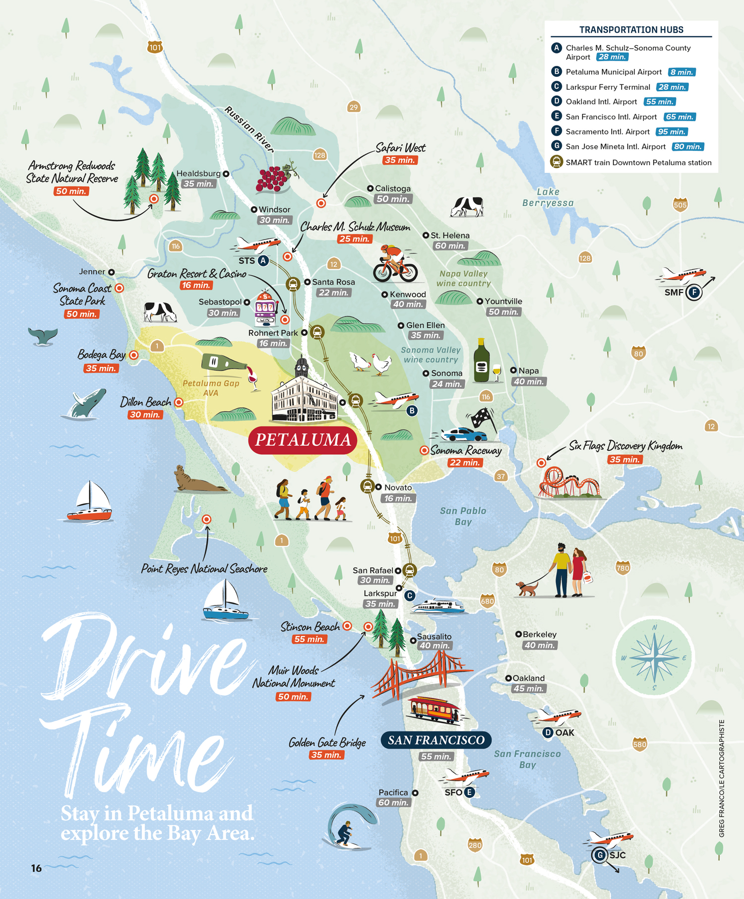
Bay Area illustrated tourist map for Petaluma
Map Purpose
Help visitors understand how centrally located Petaluma is by showing nearby attractions and points of interest across the Bay Area with estimated driving times.
Challenge
Design an area map that’s clear and engaging, accurately showing Petaluma’s position relative to key Bay Area destinations, using drive times instead of distances.
Project Description
This hand-drawn illustrated map highlights the region surrounding Petaluma (from Healdsburg to Pacifica) along with major roads and the SMART train line. Instead of measuring distance, the map presents drive times to popular nearby destinations, helping visitors easily plan day trips and outings from Petaluma.
Illustrations
The map features playful, vector-based illustrations of local landmarks, wildlife, and activities, ranging from the Golden Gate Bridge and wine country to whales and surfers. Iconic characters and custom symbols (including airplane icons for regional airports) give the map a vibrant, welcoming feel.
- UseVisitors guide
- ClientVisit Petaluma
- Related projectsDowntown Petaluma illustrated tourist map
- Type of ClientsTourism board / Destination marketing organization
- Art DirectorDeanne O'Connor for Wanderlust Content Studio
- LocationPetaluma, San Francisco, Bay Area, California, USA
- CreditsThis 100% vector map was created by Greg Franco - Le Cartographiste with Adobe Illustrator and without the help of AI. Adobe Illustrator brushes from RetroSupply Co.
