

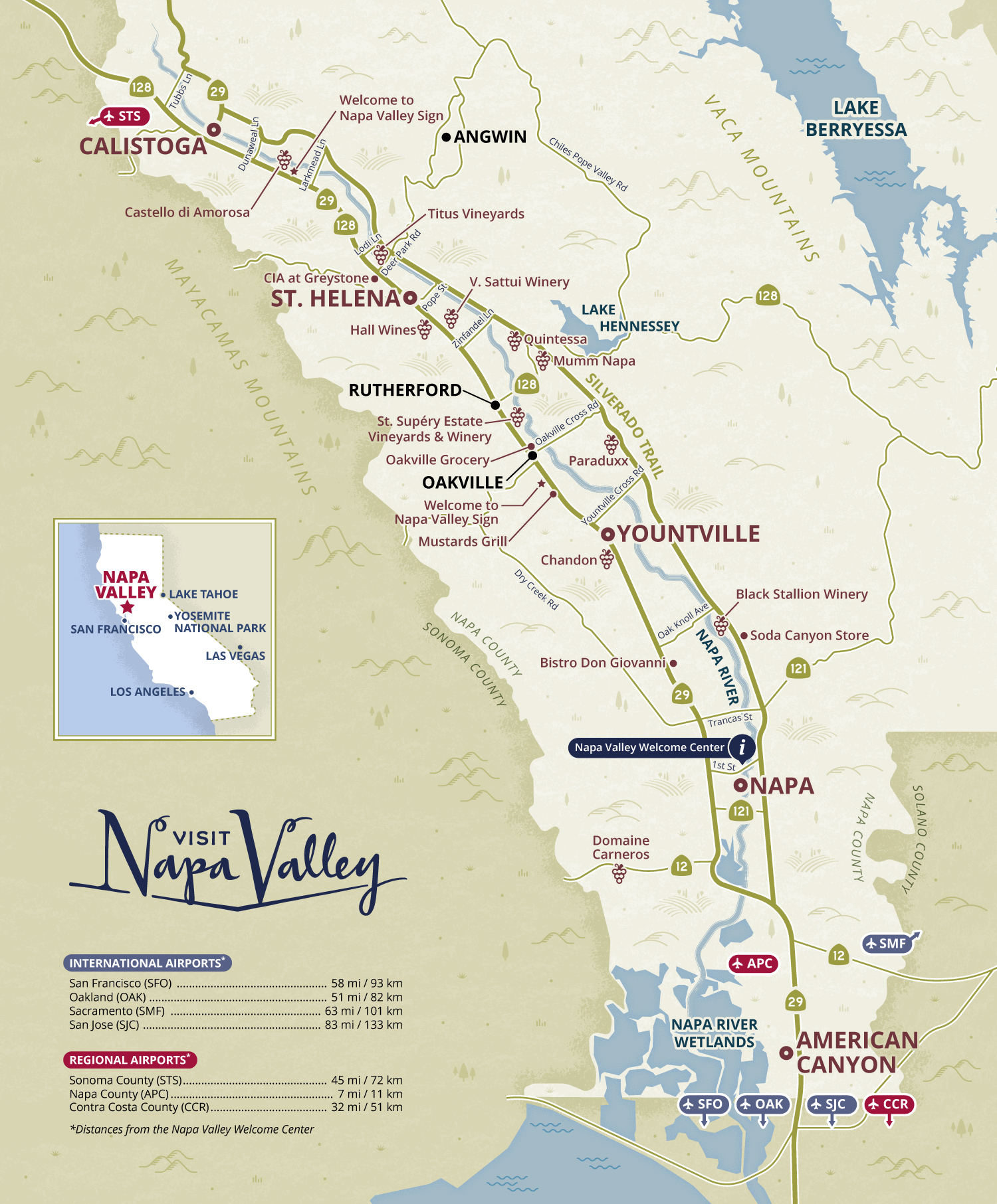
Road map of Napa Valley
Map Purpose
Help visitors easily navigate Napa Valley, highlighting key towns, wineries, and restaurants with an accurate yet visually engaging map.
Challenge
Design a practical map that maintains navigational accuracy while reflecting Visit Napa Valley’s brand style with creative, modern visuals.
Project Description
This vector-based map combines a practical cartographic approach with a fresh, branded look. Essential information like towns, major roads, and points of interest are clearly displayed, while the design avoids a traditional, bland aesthetic by using Visit Napa Valley’s official color palette and customized iconography.
Illustrations
Minimalist illustrations of vineyards, hills, and vegetation create a subtle backdrop without distracting from navigation. Unique icons were developed to mark wineries clearly.
- UseOfficial visitor magazine
- ClientVisit Napa Valley
- Related projectsNapa Valley Vine Trail illustrated map Napa Valley mustard season illustrated map Napa Valley illustrated tourist map Napa Valley food trails maps Napa Valley wine region map
- Type of ClientsTourism board / Destination marketing organization
- Art DirectorDeanne O'Connor for Wanderlust Content Studio
- LocationNapa Valley, California, USA
- CreditsThis 100% vector map was created by Greg Franco - Le Cartographiste with Adobe Illustrator and without the help of AI. Map data from OpenStreetMap Adobe Illustrator brushes from RetroSupply Co.
